
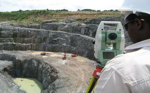
Land Survey
Cadastral, topographic, and boundary surveys for land and property management across Nigeria.
Make a Service RequestWe provide top-tier cadastral survey services for land and property management, including boundary surveys, title change, subdivisions, retracement and delineation of property lines, condominium surveys, perfection of land title, and as-built surveys.
Our field teams combine modern GNSS and total station equipment with decades of combined surveying experience to deliver accurate, defensible results for developers, estates, and private landowners.
Our Land Survey services
Cadastral surveys
Our cadastral survey unit helps clients establish and re-establish land boundaries in line with the current land laws of the Federation and the State. We advise and guide clients in all matters of land acquisition and management, including physical delineation and electronic registration as prescribed by the State.
Setting out and site layout surveys
For clients in construction and engineering who need plan-based measurements transferred accurately and precisely to real positions on site before construction begins.
Boundary and perimeter surveys
For clients who need the boundaries of a property or area of interest marked in relation to existing structures and natural landmarks.
Right of way and pipeline route surveys
A right of way survey delineates the boundaries and limits of privately owned property, mostly for the transportation of goods and services. We take special care in reviewing land titles and documents to establish the current ownership and rights on each parcel.
Easement surveys
Sometimes part of a parcel is given to another party for a particular use, even though they hold no title to the property. We create and register easement surveys on our clients’ behalf, detailing all the rights given in respect of the property.
Topographic surveys
Carried out to determine the elevation (height and depth) and position of every natural and man-made feature on a parcel of land. The contour maps and digital terrain model (DTM) produced are the framework for most civil and engineering construction.
As-built surveys
For clients who need a detailed representation of all infrastructure and improvements on a parcel, producing accurate dimensional data for record and evaluation purposes.
Control surveys
For clients who need horizontal or vertical controls established. Depending on the order of accuracy required, we use different techniques to achieve precise and accurate results.
Condominium surveys
For clients who need an individual survey of condominium units or apartments within a building or block of buildings. The survey shows the unit together with the commonly shared spaces and conveniences.
Dimension control surveys
A survey technique for accurate and precise measurement of three-dimensional space, used across industries for decades. We use modern techniques and equipment to achieve first-order accuracy in measurement, to meet our clients’ needs.
Past Projects
See all projects →Ajoonu Farms Topography and Geophysical Surveys
For Ajoonu Farms Nigeria Limited
Ajoonu Farms, Nigeria · Jul 2024
Topography Survey, Cut and Fill Analysis
For Al-Afia Group of Companies
Nigeria · Dec 2021
ROW Delineation and Marking — Ibadan–Ilorin Railway Project
For CCECC Nigeria Limited / Federal Ministry of Transport
Ibadan–Ilorin corridor · Mar 2021
Survey Detailing of Tina Courts Estate
For Private Client
Lagos, Nigeria · Feb 2021
Establishment of Second-Order GPS Controls
For Marine Platforms Nig Ltd
Nigeria · Jul 2020
L.S.D.P.C. Estate Okota Layout Setting Out
For Lagos State Development and Property Corporation
Okota, Lagos · May 2019